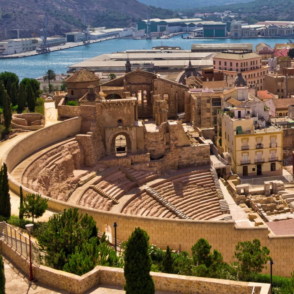

Location: Club Náutico, P.º Colón, 25A, San Javier, Murcia, Spain
Season: June 15, 2027 to July 10, 2027
Session Dates: Session #1 2027 | June 15 – June 26 $ 2800 Session #2 2027 | June 29 – July 10 $ 2800
Application Deadline: July 10, 2027
Deadline Type: Contact for Details
Website: http://archaeology.institute/050-gis-autocad-and-digital-illustration-applied-in-archaeology.asp
Program Type:
Field School, Volunteer
RPA Certified:
No
Affiliation:
Sanisera Archaeology Institute
Project Director:
Carmen Martínez Mañogil
Graduated in History (2005-2010), Master in Applied Archaeology, Professional Management and Research Strategies in Archaeological Heritage (2010-2011) and currently carrying out the specialized doctorate program in Roman Archaeology at the University of Murcia.
He applied GIS and AutoCAD techniques in his master project: "The Roman Villa of Alamillo (Mazarrón, Murcia, Spain)". His areas of interest are classical Roman archaeology, techniques used in fieldwork and survey methodology, and digital application to draw pottery and other artefacts in the laboratory. Use AutoCAD and ArcGIS on ongoing projects.
She is currently the director of the Spanish archaeological company, CMM Arqueología and works in archaeological fieldwork, survey and works supervision projects.
Since 2009 she has been an active researcher in the scientific project "Archaeological Park of the Roman Forum of Molinete" directed by the department of archaeology at the University of Murcia.
At an international level, he has collaborated with The Antiquity of Southeastern Europe Research Center (ARC) of the University of Warsaw in the Danube Limes UNESCO World Heritage project and with the Institute of Nautical Archeology of the University of Texas (USA) in the site "Bajo de la Campana (San Javier, Murcia)".
Project Description:
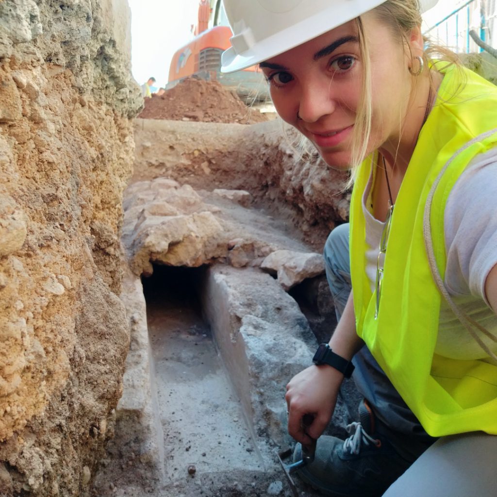
The Sanisera Archaeology Institute for International Field Schools offers an annual archaeology dig on San Javier, Murcia, on the southern coast of Spain. This course is for students who come from all over the world to study abroad and who are interested in archaeology, anthropology, mapping tools applied to archaeology, as well as for participants who want to learn about archaeological recording system with a GIS (Geographic Information System).
In addition, it includes advanced and main techniques used in an archaeological laboratory, such as technical drawing and digital illustration of archaeological artifacts. The skills that students will learn can be externalized to complete studies, publications, or reports from the pieces found on any archaeological site.
This program is divided in two parts:
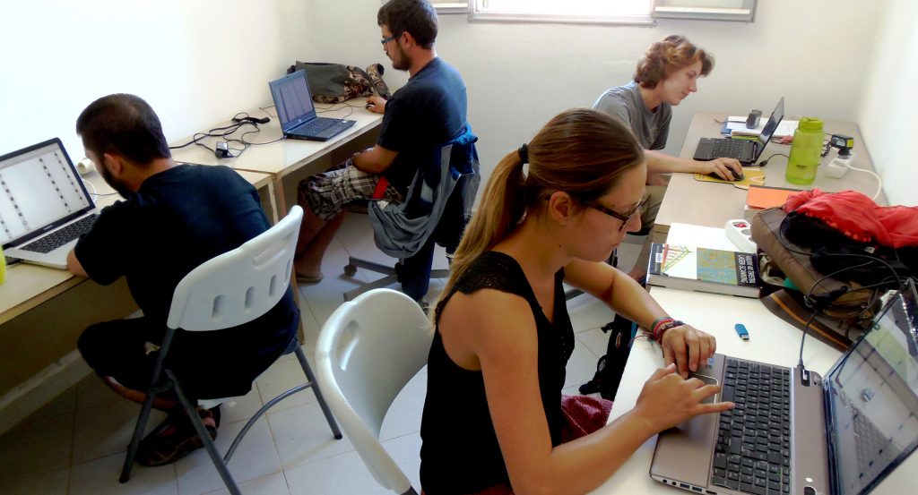
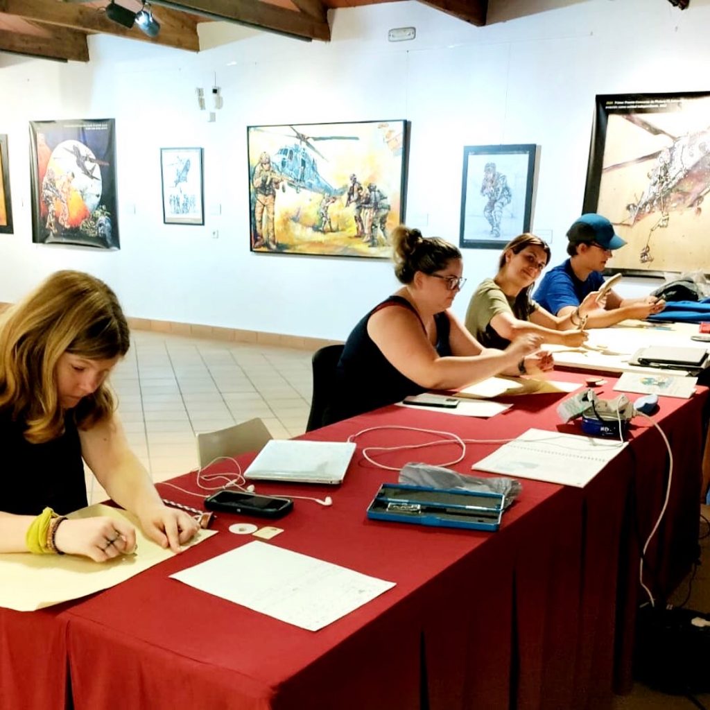
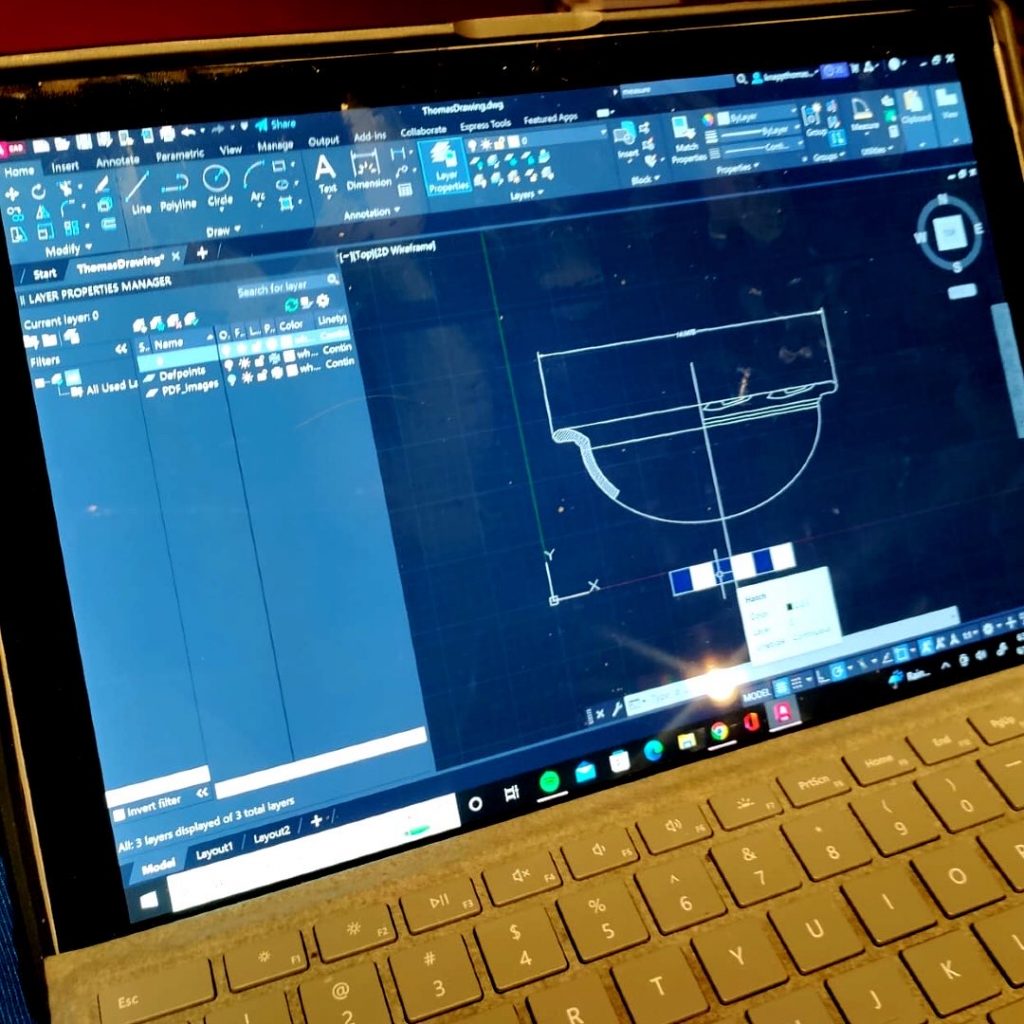
Part 1. GIS applied in archaeology & AutoCAD Software
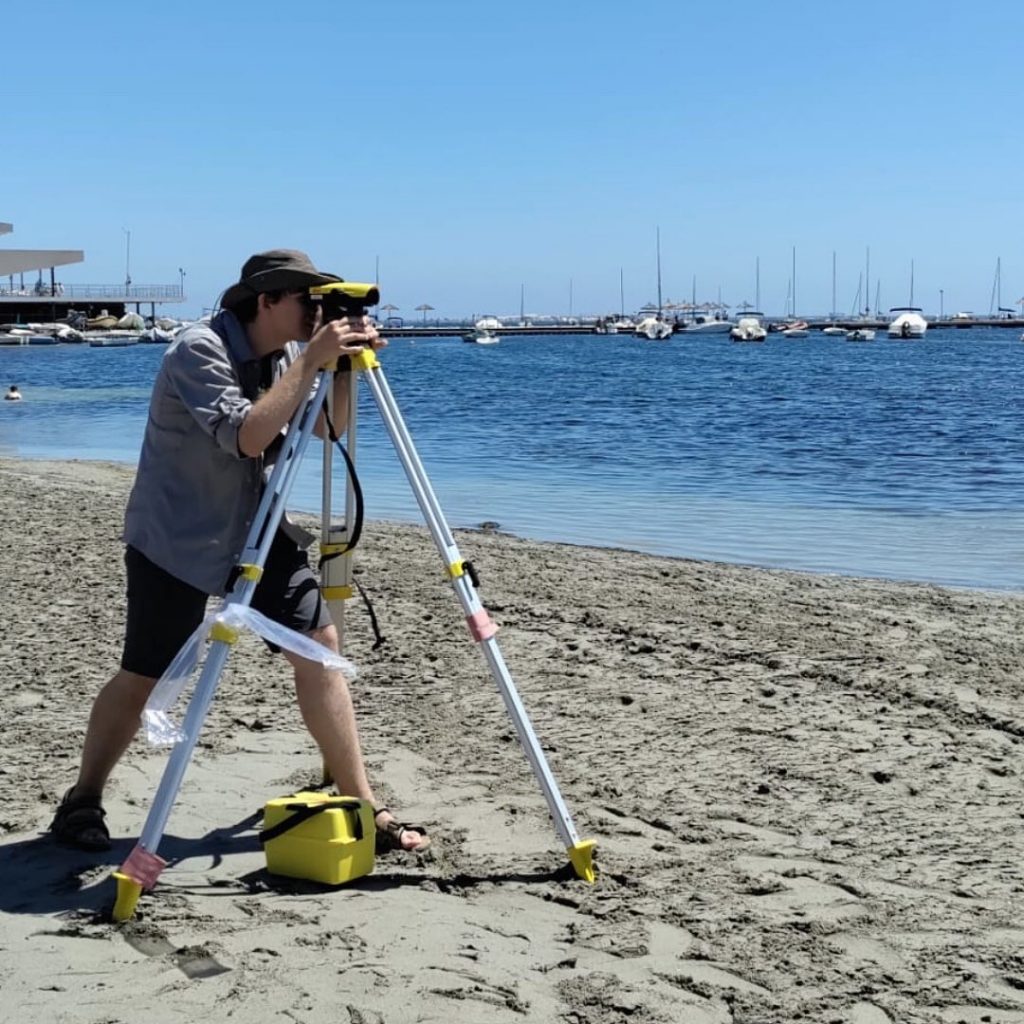
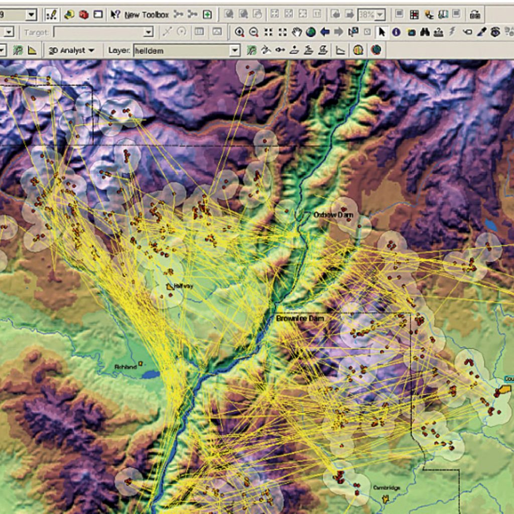
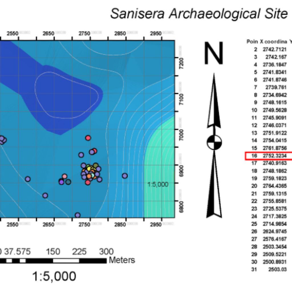
In the first week of the course you will learn to use two software: ArcGIS and AutoCAD. These two programs are used to manipulate all the graphic documentation of any archaeological investigation or excavation and achieve highest quality results.
Using AutoCAD you can create maps, sections, planimetry, without limitations. ArcGIS is highly recommended for surveying, spatial calculations of any archaeological entity that you want to analyze and integrate into a scientific project.
Time dedicated to this part of the program: 50%.
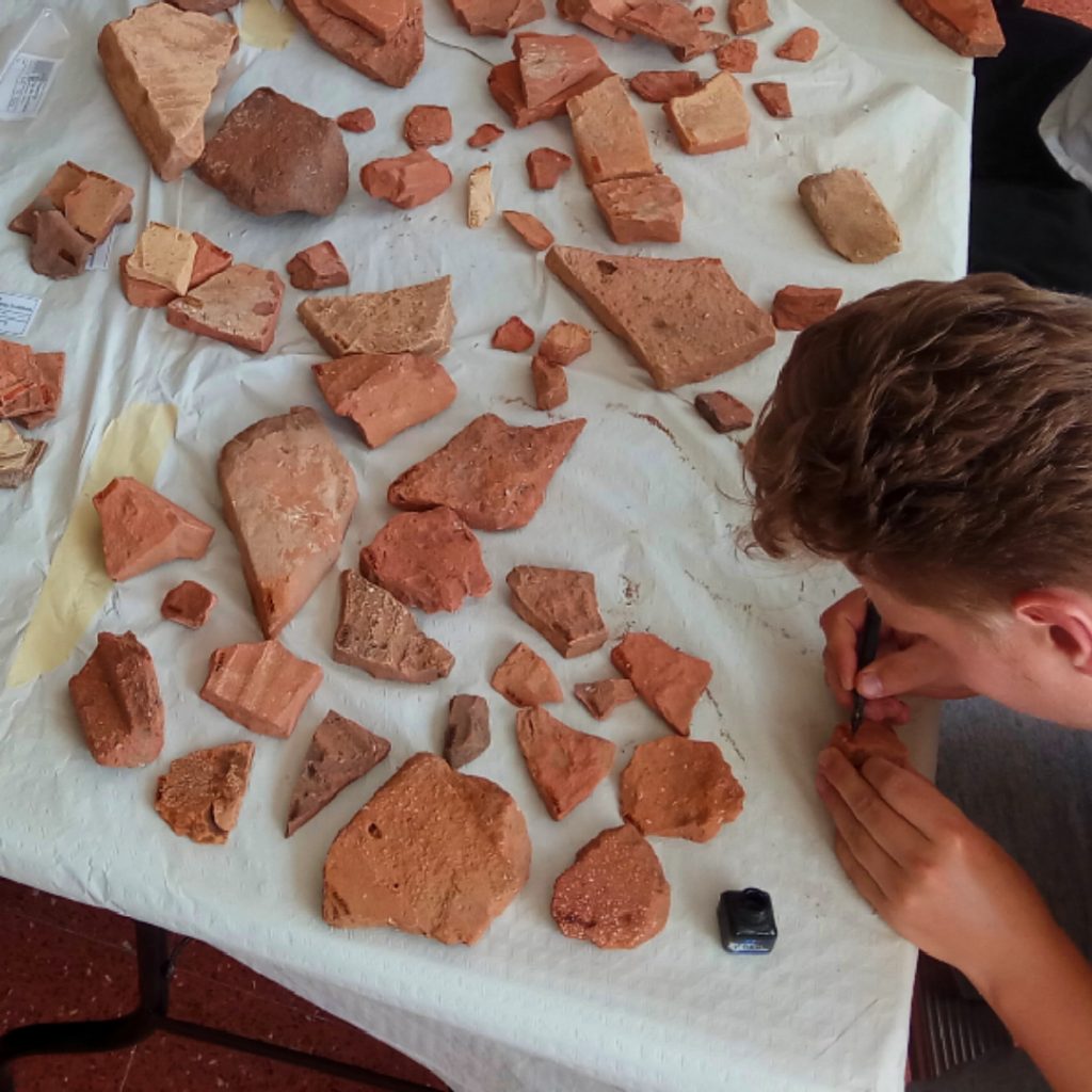
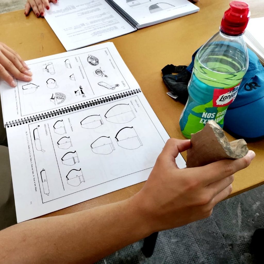
Part 2. Tools and drawing techniques and digital illustration of archaeological artifacts
In the second part the students will practice the techniques that are used in an archaeological laboratory so that they can register the main objects found on an archaeological site with the highest quality. The development of those techniques will help us to obtain drawings and digital archives that will be extremely useful for the elaboration of publications, reports or further studies.
Time dedicated to this part of the program: 50%.
What you will learn
Directed at
This course is designed for students that have participated in an archaeological excavation and would like to learn about archaeological tools used to document research information collected with rigor and quality, thanks to the handling of the field data processing translated to AutoCAD or/and ArcGIS software to create stratigraphic maps of the excavation.
If you are interested in archaeology as well as how to process this information using technical drawing, and digital illustration then this is the course you are looking for. This course accommodates participants with or without previous experience.
Learn how to excavate is the most important thing for a student who wants to become a professional archaeologist, however during the last years we have noticed that both the archaeological investigation projects and the archaeological management projects are becoming more demanding and stricter with the information gathering that take place in an excavation.
Due to current needs of the archaeology world the archaeologist must acquire more experience and knowledge in the laboratory. It´s basic to catalogue all the material from the excavation efficiently and effectively by elaborating drawings, and digital documentation that allow us to develop a rigorous research, for that reason the use of an appropriate image software has become essential for the elaboration of any report, study or publication.
This program is advanced and specialized, focusing on extracting the maximum performance from software and technology available to archaeologist.
Field School life & language
The fieldwork runs five hours per day. The day will be divided between learning mapping techniques, lab work, exercises, lectures and videos. For every five course days there are two days off. The course is taught in English and Spanish. This course takes place on a Mediterranean coast of Spain.
Sessions & Cost
| Sessions | Dates | Cost |
| Session #1 | 2026 | June 15 – June 26 | $ 2800 |
| Session #2 | 2026 | June 29 – July 10 | $ 2800 |
Elementary information:
https://linktr.ee/sanisera
Period(s) of Occupation: The Sanisera Archaeology Institute for International Field Schools offers an annual archaeology dig on San Javier, Murcia, on the southern coast of Spain. This course is for students who come from all over the world to study abroad and who are interested in archaeology, anthropology, mapping tools applied to archaeology, as well as for participants who want to learn about archaeological recording system with a GIS (Geographic Information System). In addition, it includes advanced and main techniques used in an archaeological laboratory, such as technical drawing and digital illustration of archaeological artifacts. The skills that students will learn can be externalized to complete studies, publications, or reports from the pieces found on any archaeological site.
Notes:
Certificates - At the end of the Field Program, students will receive a certificate of participation stating the hours and activities of the course. Participants that perform exceedingly well in the course may receive a letter of recommendation from our organization upon request.
Project Size: 1-24 participants
Minimum Length of Stay for Volunteers: 8
Minimum Age: 18 and young students between 16 and 18 years old can apply with special permission from their parents.
Experience Required: Previous knowledge or experience in archaeology.
Room and Board Arrangements:
Course fee includes
• Course tuition.
• Software: AutoCAD, ArcGIS, Global Mapper, Photoshop, Inkscape.
• Drawing material.
• Accommodation in the student residency.
• Walking distance to the historic center.
• Accident insurance at the school.
• Certificate of participation.
• In case of needing to process Schengen Visa the mandatory letter of invitation will be written so you can travel.
Airfare not included from the student home to Spain.
Meals are not included, although we will recommend some cafés and restaurants that do not exceed the average of 20 € /day in meals.
Entry tickets to museums and historical buildings are not included either.
Academic Credit:
http://archaeology.institute/sanisera-archaeology-institute-petition-for-credits.asp
Fernando Contreras Rodrigo
Apdo. 68
Es Mercadal
Spain
07740
Spain
Phone: +34 608894650
The AIA is North America's largest and oldest nonprofit organization dedicated to archaeology. The Institute advances awareness, education, fieldwork, preservation, publication, and research of archaeological sites and cultural heritage throughout the world. Your contribution makes a difference.